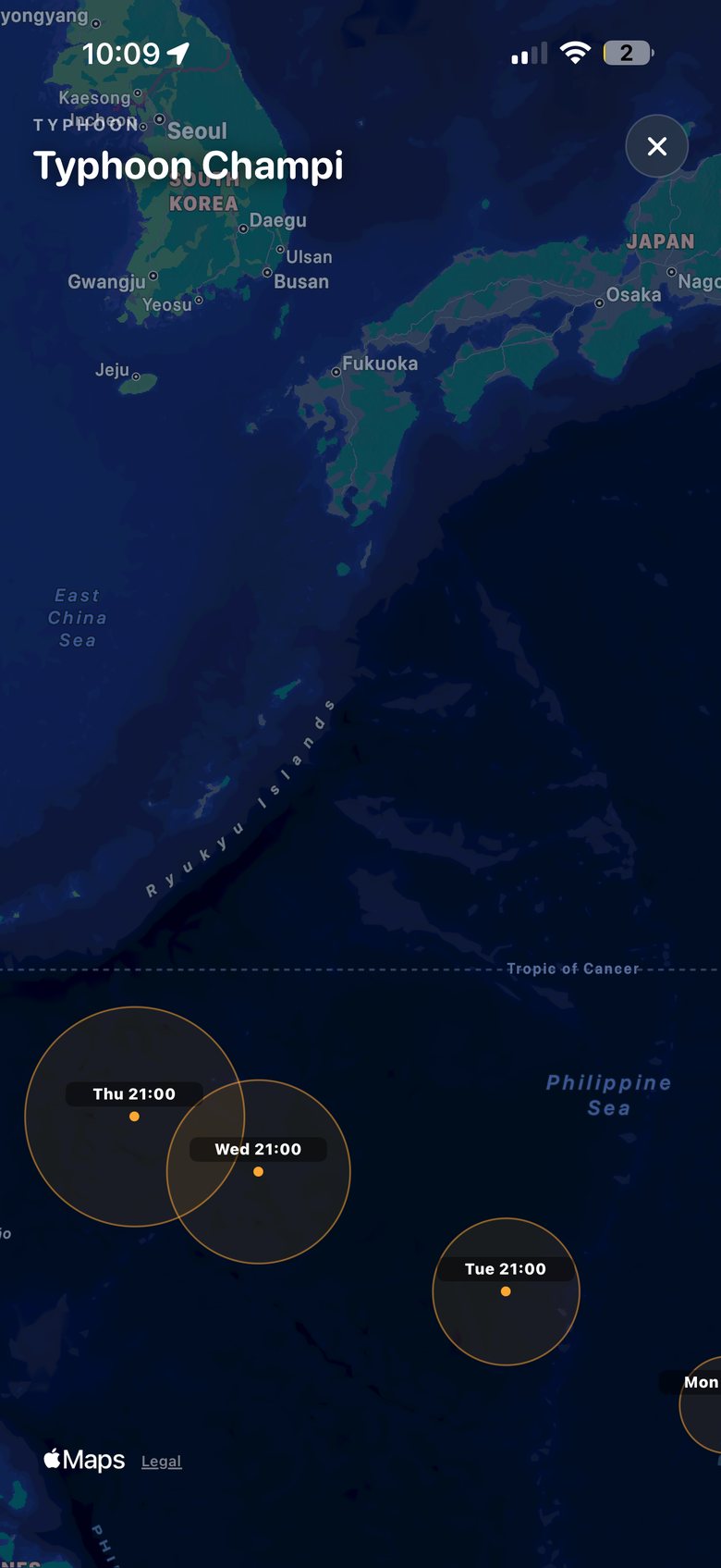
See where it could go.
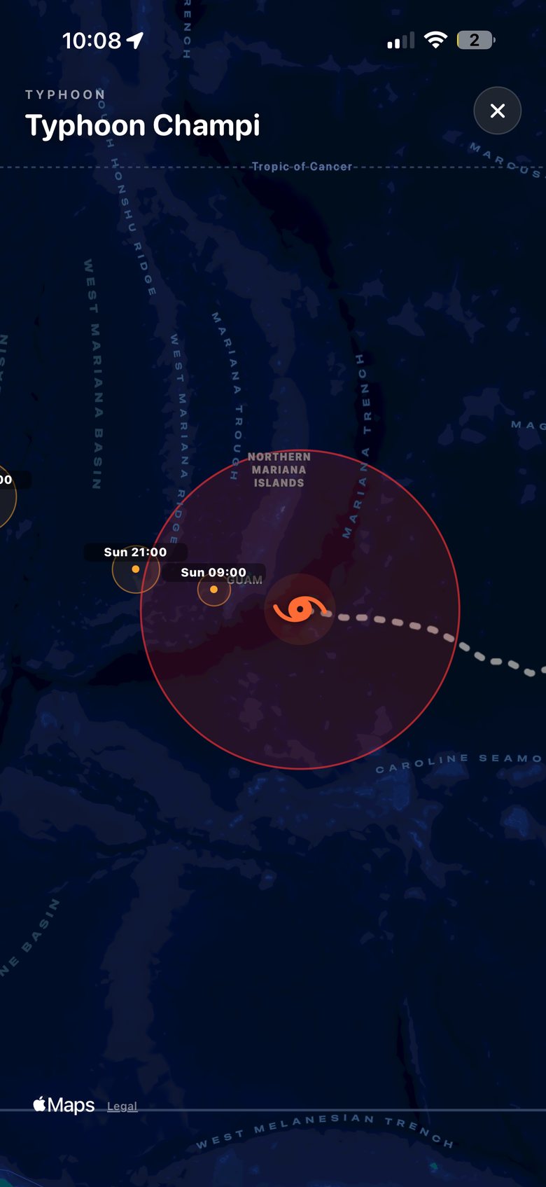
Open the map full screen and follow JMA's forecast circles from today's position to five days out.
Japan's weather warnings are precise, official and written in a code most people never learned. SHINDO reads the Japan Meteorological Agency's warnings for your exact municipality — heavy rain, heavy snow, storms, floods, high waves — and tells you in plain words what changed and what to do. When a typhoon forms, it tracks every JMA bulletin and asks AI to read the news for you, so you get the facts in one minute instead of ten tabs.
When JMA issues an advisory, warning or emergency warning for your municipality, SHINDO pushes it — named in your language, with one line on what to do. Choose a hazard to see how it arrives.
Example notification. Levels follow JMA's own system — thunderstorms are only ever an advisory, and floods have no emergency level.
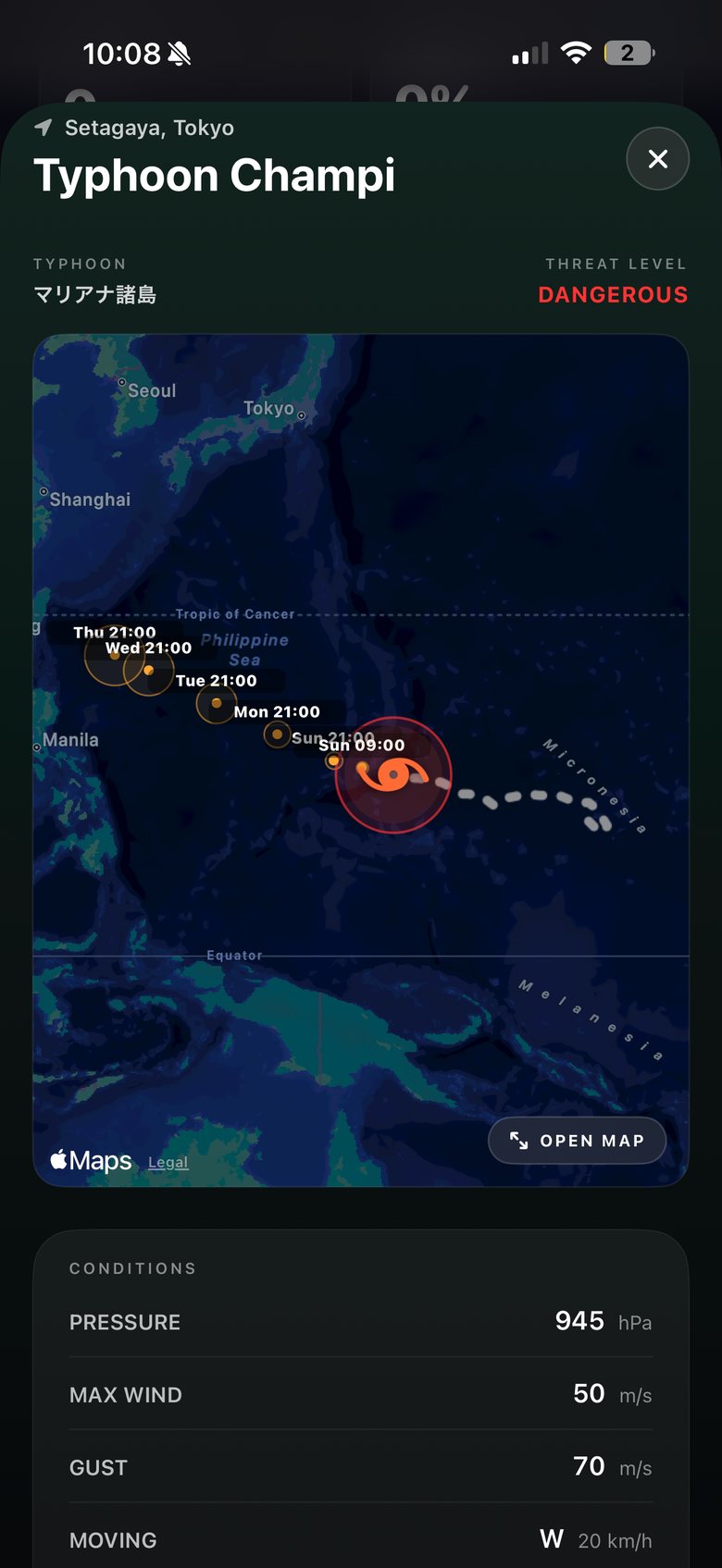
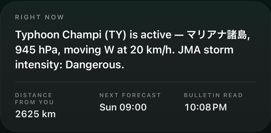
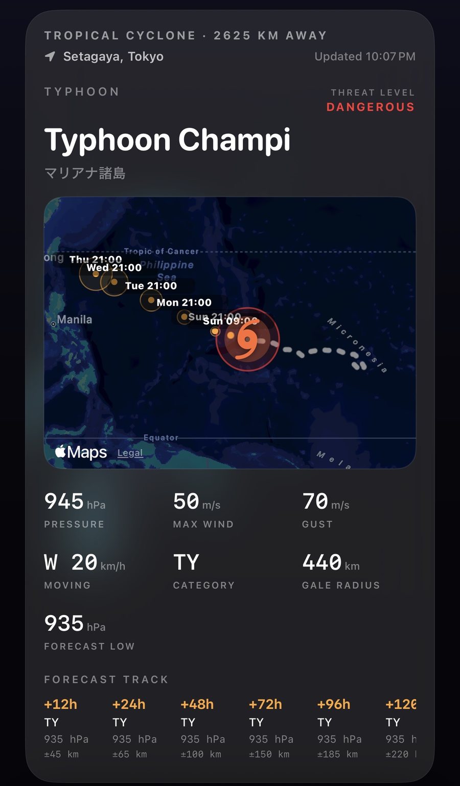
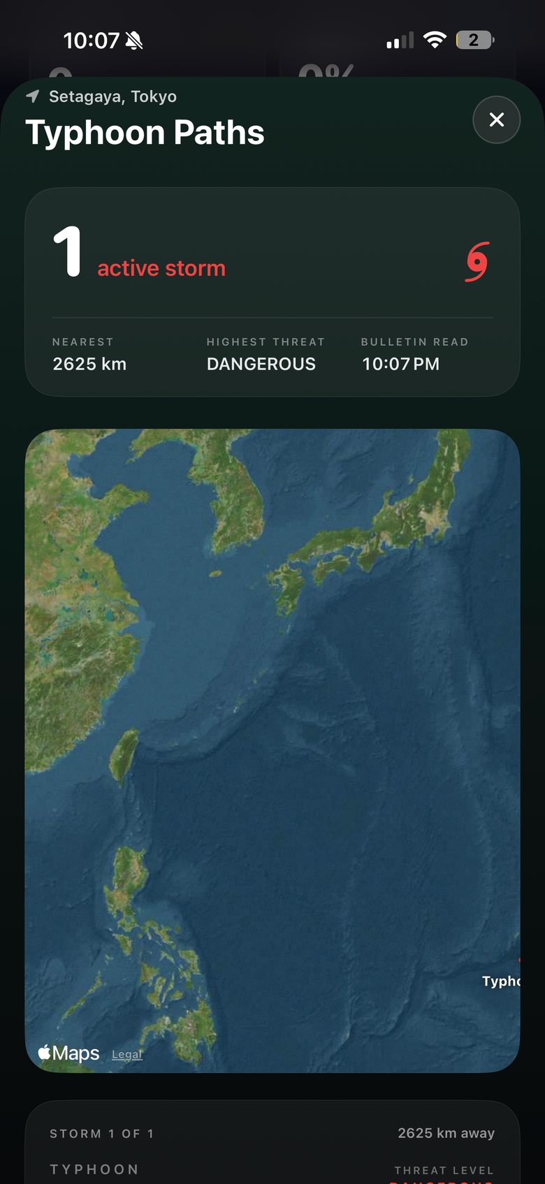
Threat level: Dangerous.
2,625 km from you.
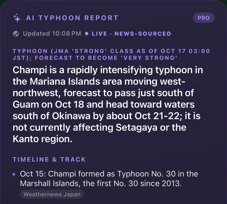
Not affecting Kanto — yet.
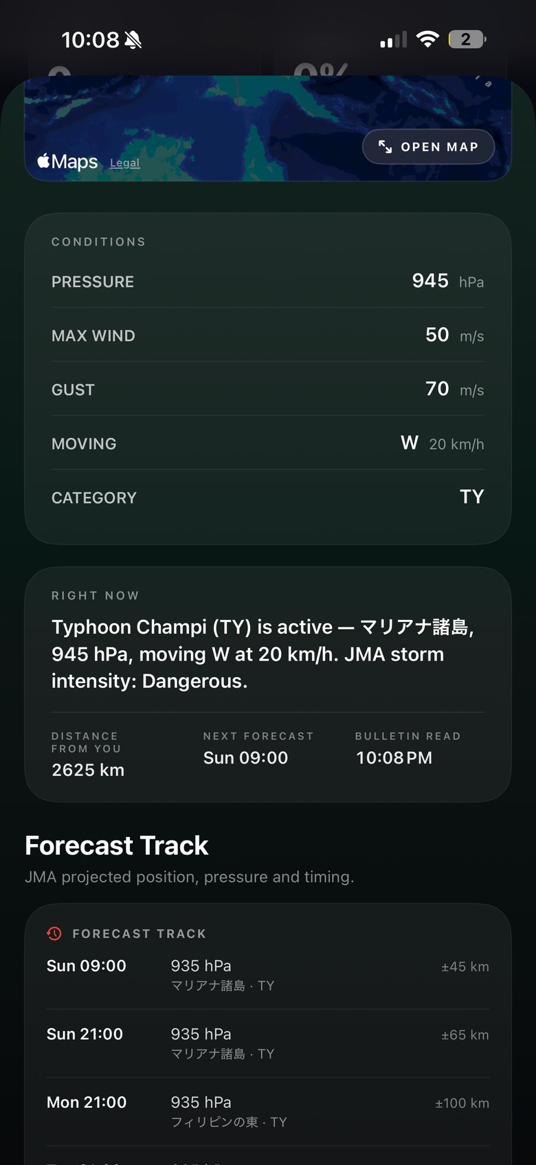
Track, pressure, wind and forecast circles are JMA's published values. Screens show the app at 22:08 on 17 October 2026, Setagaya, Tokyo.
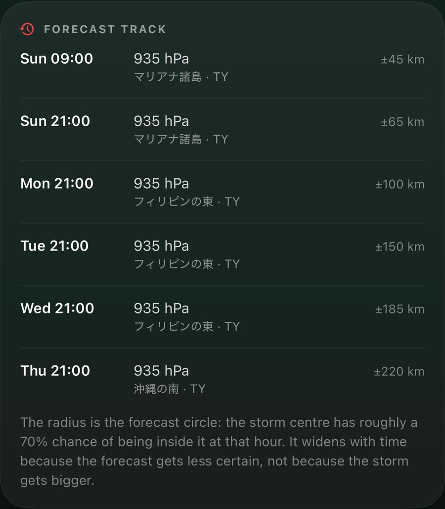
Every JMA forecast point carries a circle: the storm's centre has roughly a 70% chance of being inside it at that hour. It widens with time because the forecast gets less certain — not because the typhoon gets bigger. SHINDO draws every circle and says so in plain words.
Schematic. Circle sizes are to scale with each other, using Typhoon Champi's JMA forecast of 17 Oct (±45 → ±220 km); the track shape is illustrative.
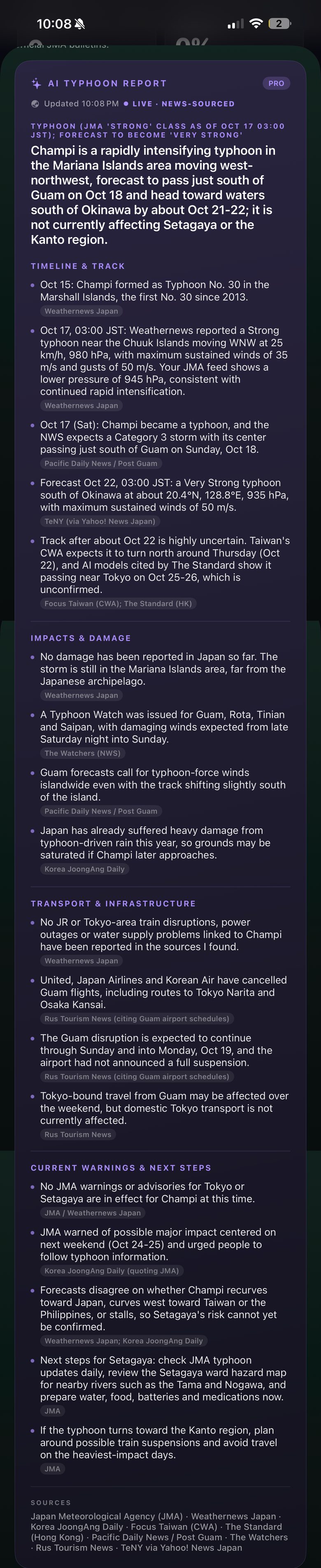
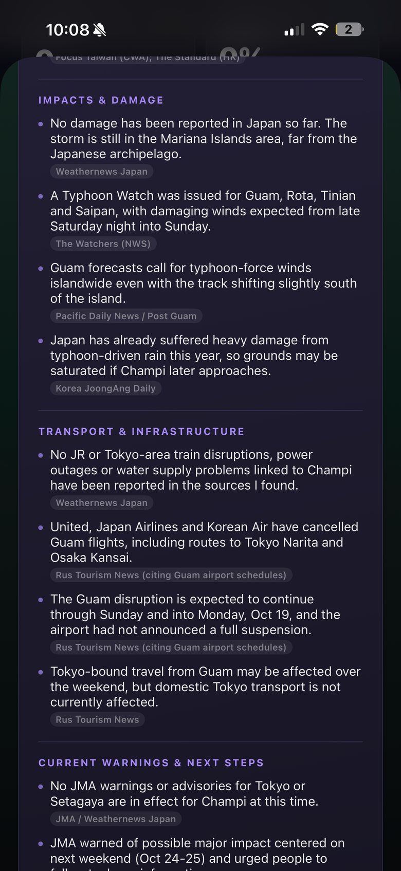
AI-generated, news-sourced briefing, labelled in the app. JMA's official figures always appear beside it and take precedence. SHINDO is not affiliated with the publishers named.
JMA's projected position, pressure and timing out to five days, on a real map you can open full screen.
Central pressure, maximum wind and gusts, speed and direction, category — and how far it is from you right now.
Timeline, impacts, transport and next steps, gathered from JMA and news wires and summarised with a source on every line.
Tropical-cyclone bulletins from the Japan Meteorological Agency, read every three hours and hourly when a storm is active.
Open the map full screen and follow JMA's forecast circles from today's position to five days out.
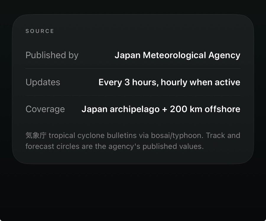
Every figure names its publisher and update rhythm. The AI explains; JMA decides.

Weather warnings, advisories, emergency warnings and tropical-cyclone information: Japan Meteorological Agency (出典:気象庁ホームページ). Typhoon screens show Typhoon Champi (No. 30) as published by JMA at 22:07–22:09 on 17 October 2026. The AI typhoon report is part of SHINDO Pro, generated from JMA bulletins and news reports and labelled as AI in the app; verify critical decisions against official JMA bulletins.
The alert demo shows example wording for Setagaya, Tokyo. SHINDO is an information service; in an emergency follow the instructions of JMA, your municipality and local authorities. How SHINDO uses AI · All data sources.