Introducing Forecast & Live Map
The next two weeks,
The next two weeks,
and the sky right now.
Every band is a day — its low at the bottom, its high at the top. Hover to read one.
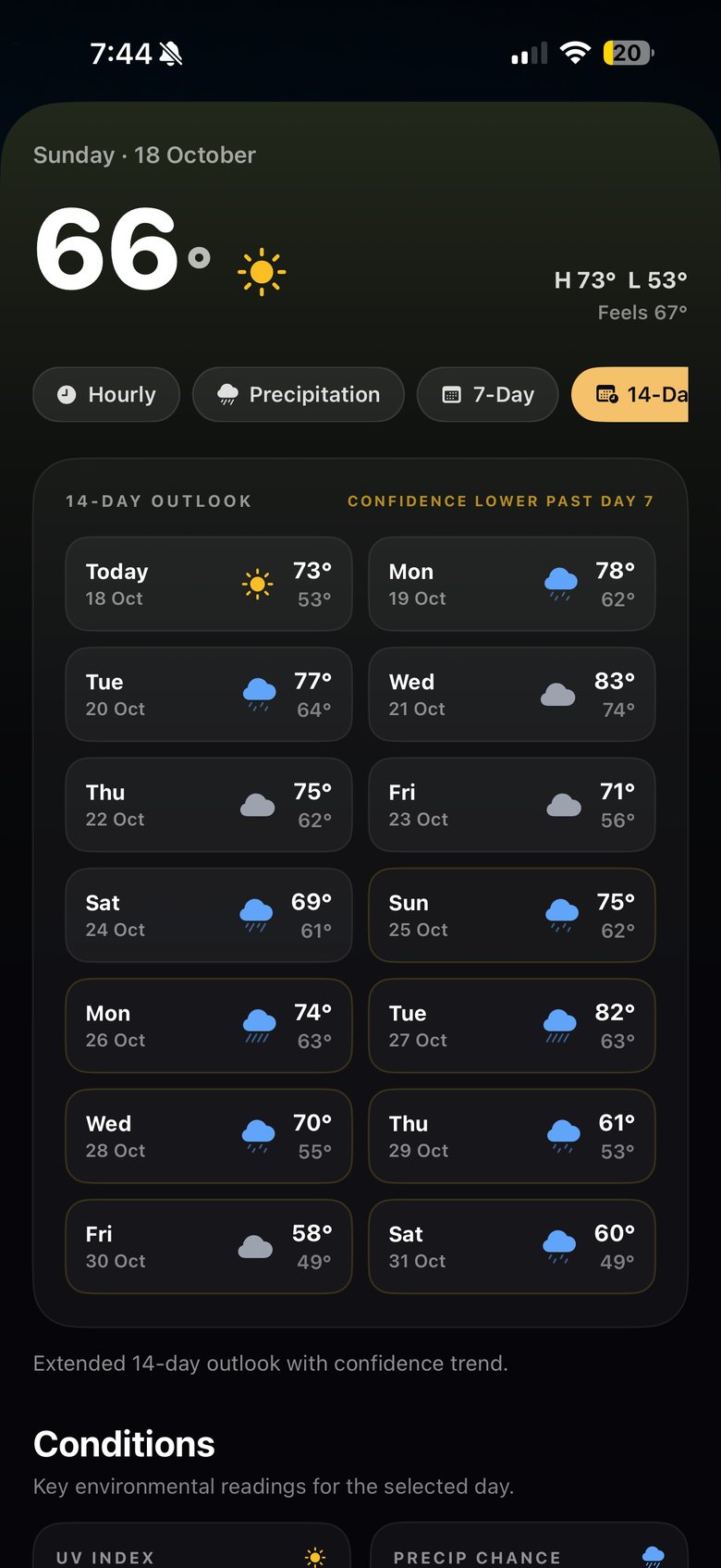
Every band is a day — its low at the bottom, its high at the top. Hover to read one.
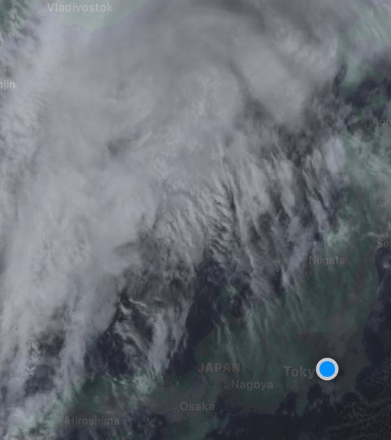
The forecast for your exact location, hour by hour and out to fourteen days — temperature, how it feels, the chance of rain, and six readings with a word on what they mean. Then the live map: Japan's rain radar, the Himawari-9 satellite, every volcano's alert level and today's heatstroke risk, straight from the agencies that publish them. In English, Japanese or Spanish, in °C or °F.
SHINDO draws the whole day as one curve, with the low and the high marked. Switch to feels-like and the curve reshapes for humidity, wind and sun. Switch to °F if that's how you think. Slide along it to read any hour.
Illustration built from the app's 18 October readings for Setagaya: low 53°F (12°C) around 6 AM, 68°F (20°C) at 8 AM, high 73°F (23°C).
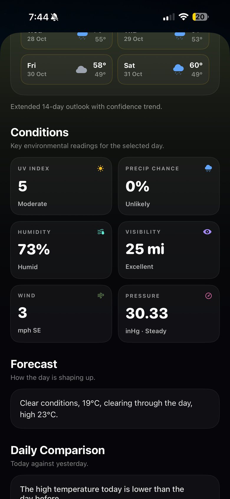
Readings as shown in the app at 7:44 PM on 18 October 2026, Setagaya, set to imperial units; metric values converted for this page.
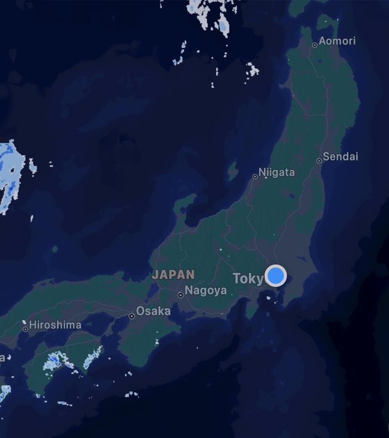
SHINDO plays JMA's high-resolution precipitation nowcast: rain observed on a 250-metre grid, updated every five minutes, and forecast ahead — at 250 m for the first 30 minutes, then at 1 km out to an hour. Drag the timeline and watch the detail change when the forecast does.
Rain cells on this page are simulated. In the app, the radar is JMA's live data.
Also on the map: typhoons, tsunami warnings, earthquakes and more.
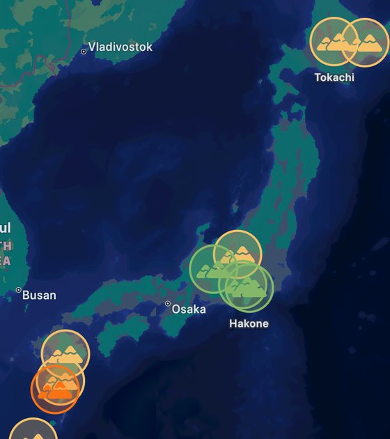
Japan has more than a hundred active volcanoes, and JMA sets an alert level for the ones it watches around the clock. SHINDO shows every level on the map and says, in your language, what that level asks of you.
Sakurajima, 12 October 2026: Level 3 continues (JMA).
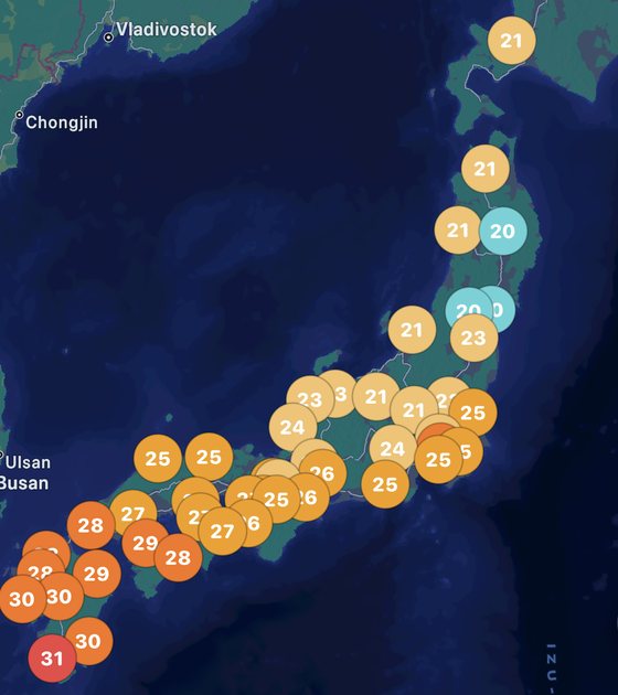
WBGT — the heat index Japan uses for heatstroke — combines humidity, the sun's radiant heat and air temperature. SHINDO maps the Ministry of the Environment's forecast peak for every prefecture, marks those under a heatstroke alert, and tells you which band you're in.
Bands from the Ministry of the Environment's guideline for daily life. A heatstroke alert is issued when any forecast point in a prefecture is expected to reach 33; a special alert when every point reaches 35. Map from the app, 18 October 2026: hottest WBGT today 31.

Forecast: weather data by Open-Meteo.com (CC BY 4.0). Rain radar (high-resolution precipitation nowcast), Himawari-9 imagery, volcanic alert levels and tsunami information: Japan Meteorological Agency (気象庁). Heatstroke risk: Ministry of the Environment, 熱中症予防情報サイト. Forecasts beyond about a week are less certain; SHINDO marks them so.
Screens show the SHINDO app on 18 October 2026, 7:44–7:47 PM, Setagaya, Tokyo. The curve, radar and volcano demos on this page are illustrations, not live data. SHINDO is not affiliated with or endorsed by JMA or the Ministry of the Environment. All data sources.